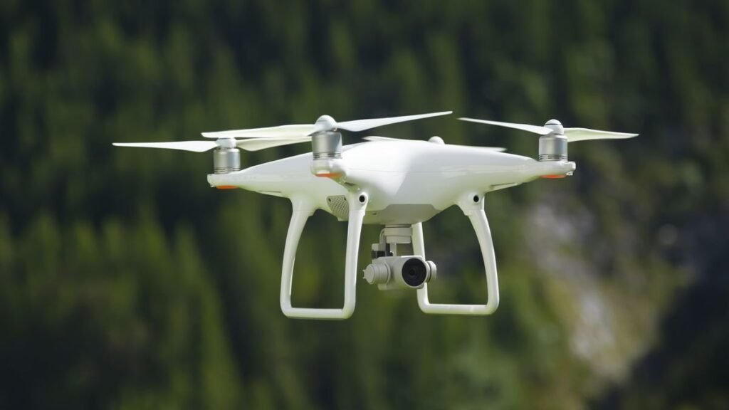
Drones, those nifty little flying gadgets, come in various sizes and can be operated remotely or autonomously, showcasing their cool ability to zip around and maintain steady flight effortlessly.
This awesome drone setup seamlessly blends cutting-edge robotics and aeronautical technology, offering a variety of power options like electric, jet, or combustion motors. Plus, it’s decked out with top-notch gear, including GPS, radar control, infrared capabilities, and high-resolution cameras.
How do drones work?
Operating similarly to helicopters and airplanes, drones come to life as their engines start, propellers spin, and they take to the skies. Guided by a remote control, pilots on the ground can effortlessly navigate these aerial marvels. With the convenience of automatic course-setting options, often utilizing GPS technology, reaching a designated destination becomes a seamless experience. The onboard camera captures the journey, allowing pilots to view the surroundings from the comfort of their command station.
It typically sports four propellers, although you can find some with three, six, or even eight propellers. These propellers are usually designed with two blades each, and for that steady hover in the sky, two spins clockwise while the rest go in the opposite direction.
Just like how we rely on our inner sense of balance, drones have their version called the “central flight controller.” This nifty device not only keeps it steady but also acts like a high-tech compass, gauging the magnetic field’s strength and direction. Through GPS, it stays in the know about the drone’s location, sharing the deets with the electronic Speed Control to ensure the motor spins just right for a smooth and secure flight.
Drones, with their versatile capabilities, find applications in various aspects of our lives, from business and civil projects to inspecting infrastructure and enjoying recreational activities. Some ways people use drones include:
- Search and rescue.
- Monitoring traffic.
- Weather measurements and observations for fire fighting.
- Applying pesticides, irrigation systems, and harvest monitoring.
- Military defense of the airspace to distinguish objects from people and the search for bombs or weapons.
- Border surveillance.
- Archaeological inspection.
- Animal tracking for research purposes.
- Recording for audiovisual productions of scenes that were previously impossible or very expensive to shoot.
Spanish drone regulations
AESA, the Spanish Aviation Safety and Security Agency, oversees the responsible use of it, ensuring compliance with European Regulations RE 2019/947 and RD 2019/945, while keeping in mind that RD 1036/2017 stays applicable until January 1, 2022.
Drone pilots should consider the following:
- The aircraft must be within the pilot’s field of vision.
- The flight must stay at less than 120 meters in altitude.
- Flying within an 8 km perimeter around an airport, airfield, or controlled airspace is prohibited.
- Every drone must carry an identification plate.
- Recording people or disclosing images of them without prior authorization is prohibited.
Currently, if you’re not part of the Spanish law enforcement (the FCS, in Spanish), and it weighs 250 grams or more, all you need is a recognized training certificate. For breezy, low-risk flights falling under the open category, no special permission or pre-flight paperwork is necessary – just nail the AESA exam at level 1 or 2. However, if your drone adventure falls into the specific category, meaning it doesn’t fit the open category criteria and requires prior approval, buckle up for the level 3 exam and a safety study submission.
Yet, the latest rules have done away with the separation between business trips and recreational journeys, now simply mandating civil liability insurance for both.
Drones and sustainability
As the years have passed, the bond between drone technology and the realm of sustainability has only deepened, paving the way for remarkable advancements:
- With the help of advanced drones equipped with high-definition cameras, we can now capture detailed images of vast agricultural fields and expansive land areas, eliminating the need for traditional ground or air surveying vehicles that contribute to increased emissions.
- It plays a crucial role in keeping solar and wind plants in check by spotting issues like equipment failures, material losses, or malfunctions, all without the hassle of sending people onsite. This not only saves us fuel, time, and money but also ensures a more efficient and cost-effective operation.
- Using drones equipped with sensors, we can effortlessly gauge air quality, pollen levels, and atmospheric conditions, gathering valuable data to uncover patterns and conduct insightful climatological studies.
Fun facts about drones
- You can now shop online in the United States and have 2.3 kg packages delivered to your doorstep within 30 minutes, all thanks to the convenience of drone deliveries!
- Lately, people have been employing drones for personal adventures, snapping shots of scenic spots and creating breathtaking panoramas. This trend is not just embraced by travel and tourism businesses, but also by YouTubers and Instagrammers who love sharing their wanderlust-filled journeys and lifestyle moments.